
|
2026-27 Snowfall Predictions
|
|
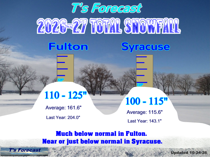
Fulton: 2026 - 27 Snow Amount: Likely Range: 110 - 125" My prediction: 120" Average: 161.6" Last season: 204.0" |
Syracuse: 2026 - 27 Snow Amount: Likely Range: 100 - 115" My prediction: 110" Average: 115.6" Last season: 143.1" |
|
No winter outlook is simple or straight forward. But this year may be a bit easier to forecast than other years. We have a very strong El Nino in the eastern Pacific Ocean. The El Nino is warming of the ocean water off of South America. And this one could be the strongest one since reliable records have been kept. So what does a very strong El Nino mean for our weather here in Central NY. The one constant with this condition is a warmer winter for us. We will still see some cold air come in. But any cold should not be long lasting and I would expect thawing between many of the snowfalls. We tend to see a warmer December especially. Remember the last very strong El Nino in 2015? We had temperatures of 65-70 on Christmas Eve! So I think we will have a warmer winter than we experienced last winter. The reason we see milder temperatures is that during a strong El Nino, the Jet Stream is quite strong in the Pacific. This Jet Stream will bring lots of rain and snow into California. This strong Jet Stream will also push milder Pacific air across the U.S. and this helps keep arctic air locked up to our north more than usual. Now with this strong Jet Stream, there is expected to be more storms spinning up and moving across the country and eventually up the east coast. We do see more Nor'Easters during El Nino winters. Lake effect snow is a big concern every winter here in Central NY. But during strong El Nino years like this year, we tend to see less lake effect snow due to less cold air. This is a big reason why I am going with much less snow than average for Fulton. Syracuse may see closer to average snowfall due to the storms coming up the east coast. One of our strong El Nino years in 1997-98, Syracuse actually picked up a couple of more inches of snow than Fulton did for that winter. Now there are a few things in the atmosphere that could throw in a wrench in our winter. One is a quick expansion of snow cover over Siberia here in October. This usually will tend to set up colder air to come our way toward mid winter. Also the polar vortex is just strengthening over the North Pole. But there could be some weaking of the vortex already this fall. Any weakening can make that pocket of cold air push down south toward our area. But right now, I believe that this possibly strongest El Nino on record, will be our main weather driver for our winter season. We will see snow this winter. And for the Syracuse area I am expecting near normal to a bit below normal snowfall. Syracuse normally sees around 115". I'm thinking around 100-115". But for the Fulton and Oswego County area I expect less than normal snowfall. Fulton's average snowfall is around 162". I'm expecting around 110-125" for this winter season. Seasonal forecasts are still quite difficult to nail down as there are so many variables across the globe that effect our weather. Every year seems to have different conditions that make predicting the winter season challenging. By looking at the past data and conditions that are setting up this fall, I try to give my best guess on what we can see for this coming season. Many of these clues from the past do not give us a perfect comparison for our future weather. Snow can be a hassle and an inconvience for many of us. But try to get out and enjoy it. Spring is right around the corner. |
