
Updated on June 13, 2025 @ 3PM
|


Now updated for 2025!
Current Weather Links:


2024-2025 Seasonal Snowfall Total
Fulton: 185.7" Syracuse: 115.4"
through April 16, 2025
Fulton: 185.7" Syracuse: 115.4"
through April 16, 2025
Additional Links:
SUNY Oswego Webcam
New York State Golden Snowball Award Contest
2007 Oswego County Lake Effect Storm Video
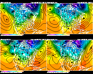
Weather Models and Links
8 Day Forecast:
Saturday |
Sunday |
Monday |
Tuesday |
Wednesday |
Thursday |
Friday |
Saturday |
 |
|
 |
|
 |
|
|
|
High: 70 |
High: 72 |
High: 75 |
High: 80 |
High: 82 |
High: 85 |
High: 80 |
High: 75 |
Low: 61 |
Low: 61 |
Low: 64 |
Low: 68 |
Low: 70 |
Low: 63 |
Low: 69 |
Low: 59 |
|
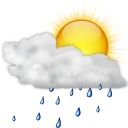
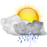
Forecast Discussion: A few showers Friday night and Saturday morning. But many places may stay dry. Any rain pulls out by mid morning on Saturday. And then we will see a mix of sun and clouds. Partly cloudy skies on Sunday. There is a chance of a couple of scattered showers. But most of the day should remain dry. Mild on Monday with a mix of sun and clouds. Warm for next Tuesday with partly cloudy skies. There is a chance of an afternoon shower. Warm and humid next Wednesday with a mix of sun and clouds. A chance of afternoon thunderstorms. Still warm and humid next Thursday with a chance of scattered thunderstorms around. Pleasant next Friday with a mix of sun and clouds. A front will give us another chance of showers or storms for next Saturday. |
Meteorologist
Anthony Corsoniti

Bachelor's of Science in Meteorology
from SUNY Oswego
Anthony Corsoniti
Bachelor's of Science in Meteorology
from SUNY Oswego